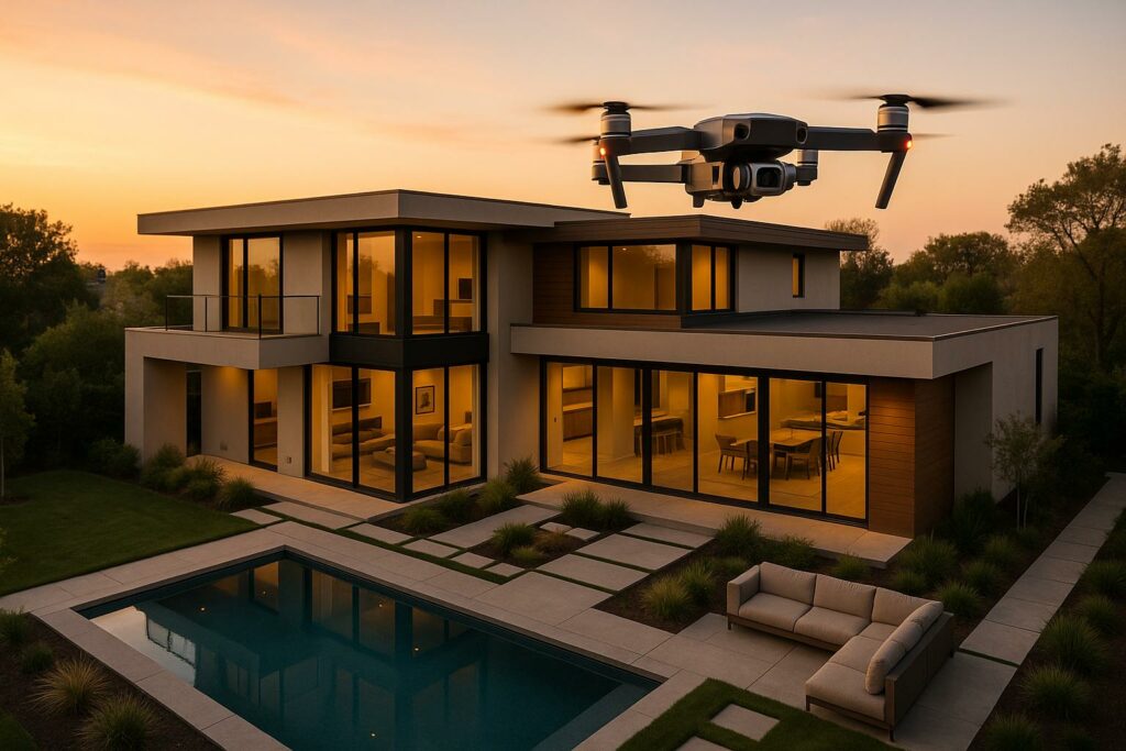
Drones have transformed real estate marketing by offering stunning aerial visuals and advanced tools like 3D mapping and virtual tours. Properties with drone footage sell 68% faster and can increase home prices by up to 10%. By 2024, 35% of realtors were using drones, and 22% sought training to maximize their benefits.
Key highlights:
- Aerial visuals: Showcase property layouts, surroundings, and unique features.
- 3D mapping & virtual tours: Provide detailed, interactive property insights.
- Faster sales: Listings with drone visuals attract buyers quicker.
- Regulations: FAA Part 107 certification and compliance are essential.
- Professional services: Companies like HomeJab simplify drone use, offering affordable packages starting at $225.
Drones are no longer optional in real estate – they’re a powerful tool to enhance property marketing, attract buyers, and stand out in a competitive market.
Drone Photography Pricing and Licensing: A Comprehensive Guide
Key Applications of Drones in Real Estate
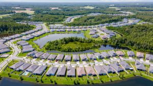
Drones have transformed the way properties are showcased, offering perspectives that traditional cameras simply can’t replicate. Real estate professionals are using drones in three key areas: capturing breathtaking aerial visuals, creating immersive 3D experiences, and performing detailed property assessments. Let’s dive into how these applications are reshaping property marketing and evaluation.
Aerial Photography and Videography
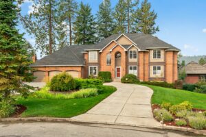
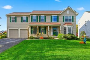
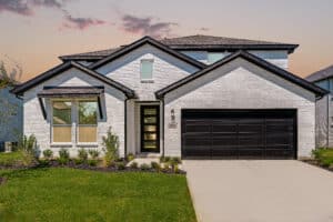
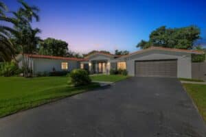
One of the most common uses of drones in real estate is aerial photography and videography. 83% of home sellers prefer agents who use drone photography, and around 80% of listing agents already incorporate drones into their marketing strategies. These numbers highlight just how impactful aerial visuals are for property marketing.
"Using drones in real estate marketing allows you to show the property from many unique angles, allowing the prospective buyer to view not only the house, the roof and yard, but also the surrounding neighborhood and views." – NAR
The financial upside is hard to ignore. Listings with aerial images can increase home prices by as much as 10%. Why? Drones capture features that ground-level photography simply can’t, like expansive yards, architectural details, or scenic surroundings. These high-resolution images and videos are particularly effective on social media and other digital platforms, helping listings reach a wider audience and generate more engagement.
For example, drones can highlight unique elements like pools, tennis courts, or intricate facades. They’re also invaluable for commercial properties. A case in point: DroneGenuity’s work in Randolph, Massachusetts, where they showcased Cox Engineering’s new manufacturing facility through aerial and interior footage. This approach helped the company highlight its expanded capabilities to potential clients.
"Unique photography and professional videography make a significant difference in capturing buyers’ attention and compelling them to action." – Luxury Presence
To get the best results, agents should carefully plan their shots and take advantage of optimal lighting conditions to produce stunning, balanced visuals.
3D Mapping and Virtual Tours
Drones don’t just create beautiful visuals – they also enable interactive, digital experiences. By capturing numerous images, drones can generate highly detailed maps and 3D models. These tools offer buyers a deeper understanding of properties, both inside and out.
Matterport 3D virtual tours, for example, have been shown to engage viewers 300% more than traditional 2D images. This increased engagement translates into more qualified leads and fewer time-wasting showings.
"Matterport is helping us draw in interested and qualified buyers before they even visit the house. We’ve been able to increase the efficiency of our agents by not having as many live showings, and focusing our time on the more serious buyers." – Josh Fernsby, The Fernsby Brothers
Drones can create precise 3D renderings of both interiors and exteriors, giving buyers a full understanding of a property’s layout and dimensions. This is especially useful for out-of-town buyers or investors who need detailed insights before committing to an in-person visit.
The technology also allows for versatility in presentation. 3D models can be integrated into VR platforms for immersive tours, or used to create dynamic fly-through videos that highlight key features. These models can be easily shared online or embedded on websites, making them a powerful marketing tool.
Real-world examples illustrate the practicality of this technology. Prodigo, a French start-up, uses PIX4Dmapper to design landscapes without physically entering properties. Similarly, Pix4D software enables drones to create accurate, measurable 3D roof models in just minutes.
"We always say the first showing is happening online. Matterport is really the only product that exists today that enables visitors to really control their experience with a property online and understand how it flows before they even visit." – John Loughty, Loughty & Everett
This shift toward online-first experiences aligns with how buyers search for properties today, as 90% of home buyers start their search online.
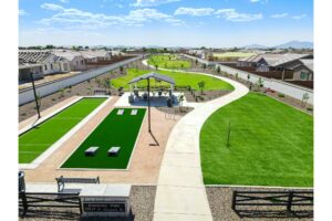
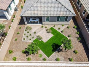
Site Analysis and Property Inspections
Drones also play a critical role in property evaluation and site analysis, offering insights that ground-level inspections can’t provide. Aerial photography not only enhances marketing but also supports tasks like boundary surveys, roof inspections, and condition assessments.
For large commercial properties or undeveloped land, drones can quickly survey entire sites, identifying issues or opportunities that might be missed from the ground. They can document drainage patterns, assess roof conditions, evaluate access points, and map property boundaries with precision. This ability to navigate hard-to-reach areas safely and efficiently reduces liability risks while delivering thorough, actionable data.
Drones are particularly valuable for investors and developers conducting due diligence. Aerial surveys can uncover site conditions, neighboring property dynamics, and environmental factors that influence property value or development potential. This level of detail not only informs smarter investment decisions but also supports more accurate property valuations.
Technology Advances in Real Estate Drone Services
The role of drone technology in real estate marketing has grown significantly, offering features that seemed out of reach just a few years ago. With advancements in imaging and intelligent flight systems, drones now create visually striking content while also providing meaningful insights about properties.
High-Resolution Cameras and Imaging
Today’s drones come equipped with high-resolution cameras capable of recording 4K video, ensuring properties are showcased in crisp, vivid detail. Larger sensors, like 1-inch CMOS models, improve performance in low-light conditions and enhance dynamic range. Features such as adjustable apertures and 3-axis gimbals ensure smooth, steady footage. HDR imaging captures details even in high-contrast scenes, and listings featuring drone visuals are shown to sell 68% faster.
Interestingly, 57% of buyers now expect to see at least 8–10 aerial shots when browsing residential properties. Advanced flight modes and obstacle avoidance systems make it easier to capture complex shots safely and efficiently. For best results, professionals often shoot in RAW format and use ND filters to achieve balanced, market-ready visuals. These imaging improvements are also paving the way for drones to integrate seamlessly with virtual property experiences.
Integration with Virtual and Augmented Reality Tools
Beyond capturing stunning visuals, drones are now at the forefront of creating immersive VR and AR experiences for real estate. By combining drone footage with virtual and augmented reality, buyers can explore properties in ways that feel interactive and engaging. Drones collect the video and spatial data that power VR/AR platforms, enabling potential buyers to tour homes remotely.
For example, AR tools can overlay digital details about nearby amenities, schools, or shopping centers directly onto drone footage, enriching the experience. A great example is Creative AVR‘s AResidence app, which combines drone visuals with interactive property data. Real estate businesses are increasingly leveraging these technologies to attract buyers from distant locations, offering a complete and compelling virtual experience that includes essential aerial perspectives.
sbb-itb-82c5f45
Regulations and Best Practices for Drone Use in Real Estate
Using drones in real estate requires strict adherence to FAA guidelines and local laws to ensure safety and legal compliance.
FAA Regulations for Commercial Drone Use
If you’re a real estate professional planning to use drones for business, you’ll need to secure a Part 107 Remote Pilot Certificate from the FAA. This certification isn’t just a formality – it involves passing a written test that covers crucial topics like airspace rules, weather conditions, and flight operations.
Additionally, every drone used for commercial purposes must be registered under Part 107 and equipped to transmit Remote ID information. This system allows authorities to monitor drone activity and maintain accountability in the skies.
When flying, stick to these rules:
- Stay at or below 400 feet.
- Keep the drone within your visual line of sight.
- Avoid flying over people, vehicles, or crowds.
Be especially cautious near airports, as restricted airspace can make some locations off-limits. Ignoring these requirements can lead to serious consequences, including civil fines up to $27,500, criminal penalties as high as $250,000, and even up to three years in prison. Clearly, proper certification and registration are non-negotiable for anyone using drones in real estate.
Privacy and Safety Considerations
FAA regulations primarily address airspace safety, but real estate professionals must also consider privacy laws and local rules. Many states and municipalities have additional requirements, especially regarding surveillance and recording private property.
To stay on the right side of the law:
- Obtain written consent from property owners for drone flights.
- Notify neighbors when possible.
- Avoid flying over neighboring properties without explicit permission.
- Disclose any use of drone footage in marketing materials.
Safety should also be a priority. Conduct pre-flight inspections, check weather conditions, and have emergency procedures in place. Keep detailed flight logs that document conditions and any incidents. If you’re hiring an external drone operator, make sure they have a valid Remote Pilot Certificate and proper insurance coverage.
Insurance and Risk Management
Drone insurance is a must for covering risks like property damage and injuries. Companies like Travelers Insurance have been using drones for claim inspections since 2016, and they rely on specialized software to manage compliance and safety.
"Drone operations software gives us an ability to manage behavior, performance and maintenance for large-scale drone operations… We’re easily able to track licenses, compliance with FAA regulations and data around each flight. All of that housed at one location, as a total drone management solution, makes Kittyhawk a very powerful tool." – Bob Gillis, UAS Program Administrator at Travelers
To manage risks effectively:
- Set clear limits on drone speed and altitude to ensure safe operations.
- Maintain detailed records of every flight, including conditions and incidents, as these can be critical for insurance claims or regulatory reviews.
Data security is another key consideration. Establish clear protocols for storing, sharing, and protecting flight data. Decide who has access, how long data is retained, and what safeguards are in place to secure sensitive property information. Training drone operators on these protocols can further reduce risks.
For added peace of mind, work with licensed and insured drone operators. This not only ensures compliance with regulations but also shifts much of the operational responsibility away from you. Following these practices will help you safely and effectively incorporate drones into your real estate marketing, setting the stage for success in this competitive field.
Using Professional Drone Services with HomeJab
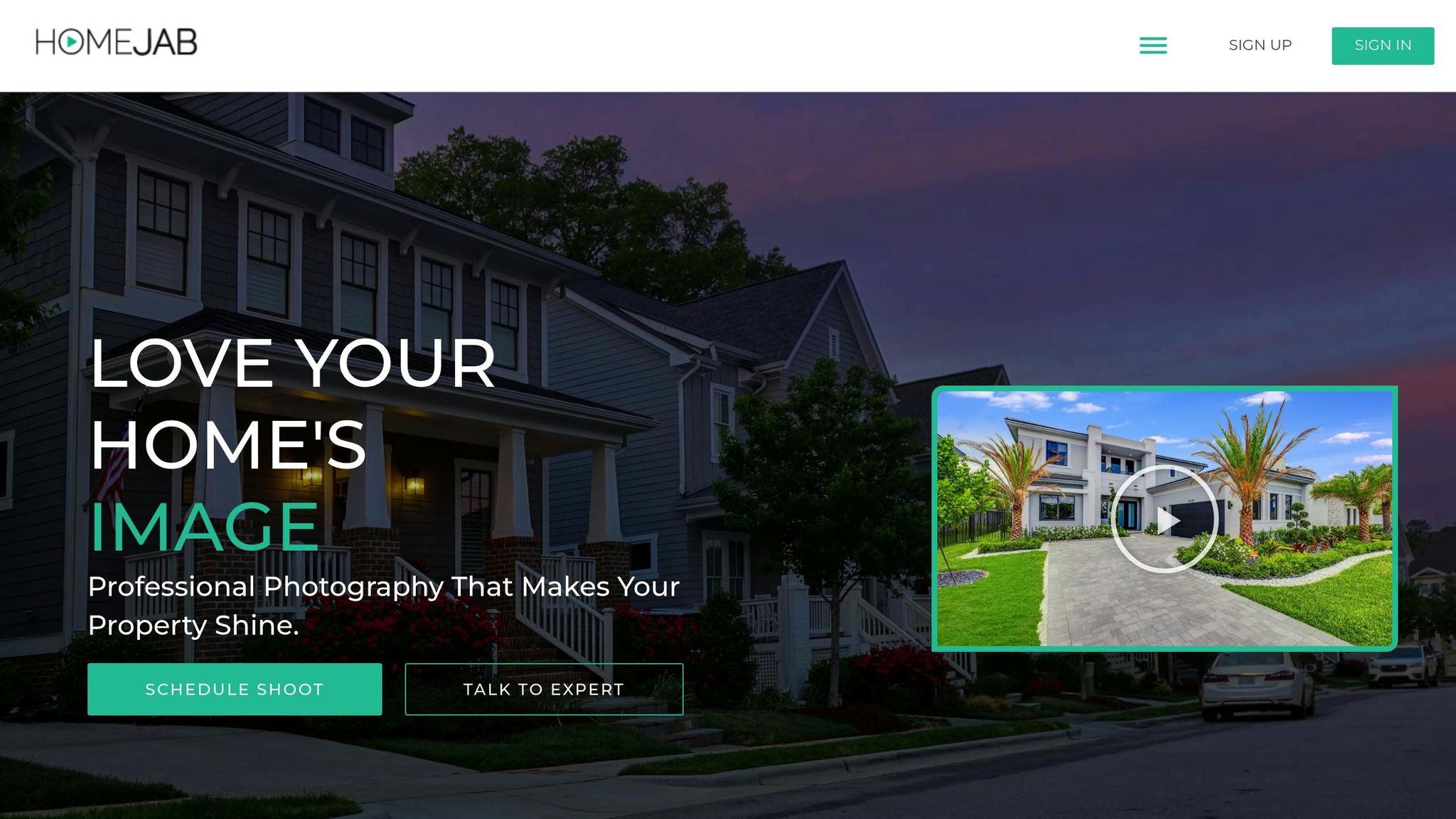
Navigating FAA regulations and mastering the technical aspects of drone operations can be daunting. Professional drone services simplify this process, offering a seamless way to enhance property marketing. By outsourcing these tasks, you avoid the complexities of compliance and technical know-how. Many real estate professionals find it more efficient to collaborate with a trusted service provider. HomeJab offers a streamlined solution, handling all the technical and legal requirements while delivering stunning aerial visuals. This allows you to focus on your core business while leveraging expert drone services to elevate your listings.
HomeJab’s Aerial Photography and Video Services
HomeJab specializes in delivering high-quality aerial photography and video services tailored for real estate. Their platform connects you with FAA-certified, licensed, and insured drone pilots, ensuring every project is executed with precision and professionalism. Services include high-resolution panoramic shots and multi-angle photos that showcase properties in ways traditional ground photography simply cannot. Additionally, their dynamic aerial videos bring a cinematic touch to property listings, making them stand out.
With coverage across all 50 states and select areas in Canada, HomeJab ensures consistent quality no matter where your property is located. In July 2025, HomeJab reported that listings featuring drone footage sell 68% faster and can boost property prices by up to 10%. These visually engaging materials not only highlight the property but also showcase nearby features like parks and schools, adding context and appeal for potential buyers.
Benefits of Using HomeJab for Drone Services
Choosing HomeJab eliminates the need for in-house drone management, saving you time and resources. Their team of certified pilots consistently delivers professional results. Moreover, HomeJab’s quick turnaround times help you stay on schedule, minimizing delays caused by weather or other logistical challenges. With an impressive 4.8-star rating from over 1,000 reviews [22,24], real estate professionals frequently praise HomeJab for its reliability, fast delivery, and exceptional visual content.
By managing everything from flight planning to delivering polished, marketing-ready visuals, HomeJab allows you to focus on connecting with buyers, free from the hassle of post-production work.
Pricing and Packages for Drone Services
Professional drone services don’t have to break the bank. HomeJab’s pricing for aerial photography starts at $225, making it accessible for various property types and budgets. They offer flexible packages designed to meet different marketing needs, giving you the freedom to tailor services to your specific goals. For properties that benefit from aerial perspectives, consider the property size and unique features when selecting a package.
The pricing reflects the value of aerial imagery in property marketing. With proven results – faster sales and potentially higher prices – investing in professional drone services can quickly pay off. HomeJab’s customizable options also let you start small, perhaps with basic aerial photography, and scale up to include video services as you see the impact on your listings. This flexibility ensures you get the most out of your investment without overcommitting upfront.
Conclusion: Using Drone Services in Real Estate
Drone technology is reshaping how properties are marketed. Listings featuring aerial photos sell 68% faster, and the drone market is projected to hit $90 billion by 2025. These aerial perspectives showcase property layouts, neighborhood surroundings, and standout features, creating an emotional connection with potential buyers. In fact, 44% of renters are more likely to consider properties with drone footage.
Right now, 35% of realtors use drones for residential listings, 44% utilize them in commercial real estate, and 22% are pursuing further training. These numbers highlight the rapid adoption of aerial marketing as a strategic tool in the industry. Clearly, this isn’t just a passing trend – it’s a smart move for staying competitive.
Key Takeaways for Real Estate Professionals
Drone technology is redefining how properties are showcased. By incorporating aerial photography, real estate professionals can speed up sales and stand out as forward-thinking agents who appeal to today’s tech-savvy buyers.
But success with drones requires more than just owning the equipment. Realtors need to understand FAA regulations, carry proper insurance, and approach aerial photography strategically. For instance, building a collection of high-quality shots and angles can help emphasize each property’s unique attributes. Professional drone services can also handle the technical and regulatory hurdles, allowing agents to focus on selling properties.
Collaborating with experienced drone service providers simplifies the process. They take care of compliance, equipment management, and technical expertise, which often leads to quicker sales and potentially higher property values. This makes investing in drone services a smart business decision.
As the real estate market evolves, embracing aerial photography and videography can set agents apart. It’s not just about creating stunning listings – it’s about delivering more value to clients and growing your business. Incorporating drone technology into your strategy can elevate your listings, speed up sales, and solidify your reputation as a leader in the industry.
FAQs
What are the main advantages of using drones for real estate marketing?
Drones bring a fresh angle to real estate marketing, offering breathtaking aerial views that traditional photography simply can’t match. They provide a bird’s-eye perspective of properties, showcasing not just the home but also expansive yards, sparkling pools, and picturesque surroundings. These visuals grab buyers’ attention and make listings more memorable.
On top of that, drones streamline the process of capturing property overviews, making it easier to craft immersive virtual tours and well-rounded marketing assets. By adding drone footage to their toolkit, real estate professionals can enhance their listings, tell a richer story, and stand out in a crowded market.
What steps should real estate professionals take to follow FAA rules when using drones for property marketing?
To meet FAA regulations, real estate professionals need to secure a Remote Pilot Certificate (Part 107) by passing an FAA exam and keeping it up to date through periodic renewals. On top of that, every drone must be registered with the FAA for a fee of $5, and the registration number has to be visibly displayed on the drone itself. Operators are also required to stick to essential rules, such as flying only during daylight hours, maintaining a clear visual line of sight, and steering clear of restricted airspace.
If you’d rather not deal with the logistics, you might want to hire certified drone pilots or services like HomeJab. These professionals are not only familiar with FAA rules but also provide safe, legal drone operations while delivering polished aerial visuals to enhance your property listings.
What should I look for when selecting a drone service for real estate marketing?
When choosing a drone service for real estate marketing, prioritize their experience in real estate photography and their capability to produce clear, stable aerial images and videos. The use of professional-grade drones and expertise in highlighting property features effectively are key factors to look for.
Take time to review client feedback and evaluate their reputation to ensure they deliver reliable and consistent results. Also, consider their turnaround times and communication style to confirm they can meet your deadlines. The right service can help you create eye-catching visuals that draw in buyers and speed up the sales process.